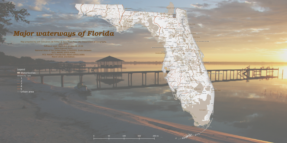
The map is made with QGIS 3.8.1 zanzibar, on pop-OS 19.04. The originator of this map is: National Atlas of the United States. Datasets: March 2016 2nd edition. Data source: The National Map Small-Scale website. This map is scaled to 1:2,000,000 for full extent. This map layer contains waterbodies, water steams and urban areas of Florida. The map layer was produced primarily from the Medium-Resolution and High-Resolution National Hydrography Dataset NHDWaterbody feature classes, through feature selection and cartographic generalization based on reference to published small-scale ancillary data sets. The propose of this map is for geographic display and analysis at large regional areas. The data should be displayed and analyzed at scales appropriate for 1:1,000,000-scale data.